

Advancing Environmental Monitoring
Our research integrates atmospheric measurement, modeling, geospatial science, engineering, data analytics, and environmental health to understand how emissions move through complex natural and urban environments. We investigate a suite of greenhouse gases and air pollutants across Western Canada and major cities, working in settings that include upstream oil and gas operations, natural gas distribution systems, wastewater and waste‑management infrastructure, landfills, feedlots, transportation networks, and broader urban systems.
Through coordinated field measurements, multi‑scale sensing technologies, new algorithms, and advanced modeling—including simulation tools and digital twins—we evaluate emission sources, mitigation strategies, and policy outcomes. Our open‑source framework LDAR‑Sim, developed within the SENST Lab and implemented by industry, continues to inform emissions‑management policy and regulatory development across North America.
Calgary Urban Methane Emissions Testbed (CURMET)
CURMET is a major transdisciplinary project designed to improve the characterization of urban methane emissions through coordinated multi‑scale measurement and modeling. The project includes a series of case studies that identify emission sources, quantify emission rates, and support the development of a new geospatial modeling system capable of estimating methane emissions at sector and city‑wide scales. These case studies apply diverse technologies and analytical approaches to examine methane emissions from natural gas distribution stations, wastewater collection networks, wastewater treatment facilities, residential and commercial meters, landfills, natural gas leaks, and other contributors to city‑level methane fluxes.
Project Years
2023-2028
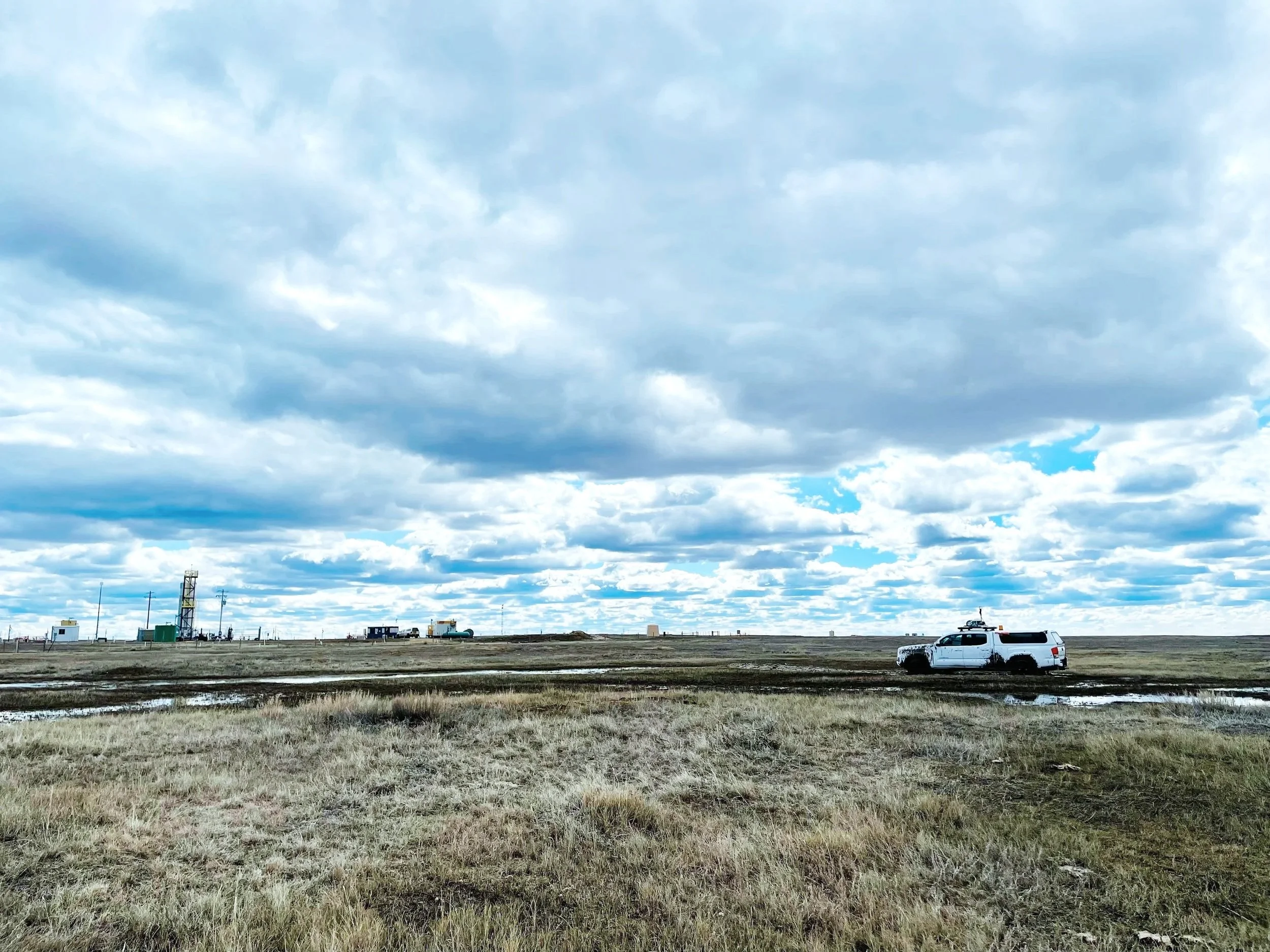
Vehicle-based GHG and air pollution sensing
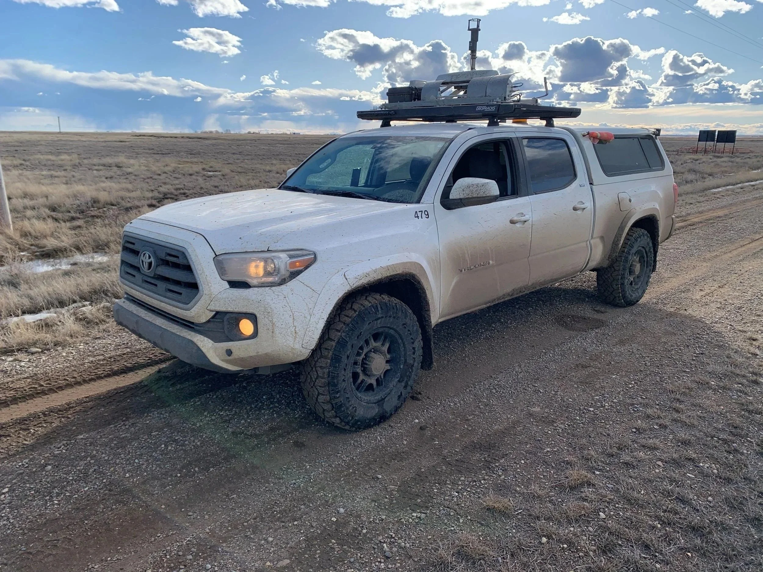
This work advances vehicle-based emissions screening methods for methane, other greenhouse gases, and air pollutants by combining mobile sensing with reproducible data-processing workflows. Many research programs in this space emphasize advanced technologies to build methane emissions inventories—critical inputs for understanding regional trends and informing policy and regulatory design—but those efforts do not necessarily translate into immediate mitigation. In contrast, our research prioritizes usability, scalable field sampling, transparent interpretation, and actionable data products. By reducing barriers to routine deployment and interpretation, our approach helps place screening capability directly in the hands of operators, practitioners, and partners who can act on findings quickly, supporting targeted follow-up and enabling substantial emissions reductions to date. Platform development has proceeded iteratively across multiple mobile configurations (commercial vehicles, robotic units, and e-bike–mounted systems), informed by prior research in mobile emissions measurement, with our next-generation vehicle platform planned for 2027.
Project Years
2017 - Present
Super-Pollutants
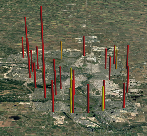
Our work on super‑pollutants in urban environments focuses on understanding how short‑lived climate forcers such as methane, black carbon, and key ozone precursors, simultaneously drive climate warming and degrade air quality in rapidly evolving city landscapes. Using coordinated mobile, aerial, and stationary measurements, combined with advanced modeling and data‑fusion methods, we generate high‑resolution spatial and temporal profiles of these pollutants across major urban systems. This research aims to identify hidden emission hotspots, quantify contributions from sectors such as transportation, natural gas distribution, and waste infrastructure, and link dispersion patterns to both climate impacts and human exposure. By integrating these measurements with digital twins, plume‑modeling frameworks, and geospatial analytics, we provide city‑scale emissions intelligence that supports targeted mitigation strategies, improved air‑quality outcomes, and evidence‑based climate action in growing metropolitan regions.
Year
2024 - Present
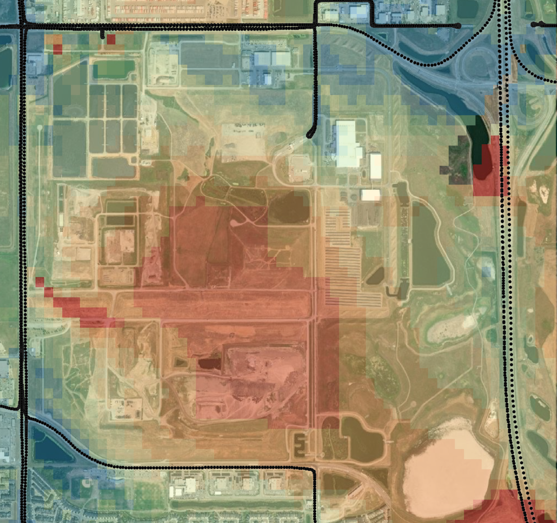
Plume Modeling
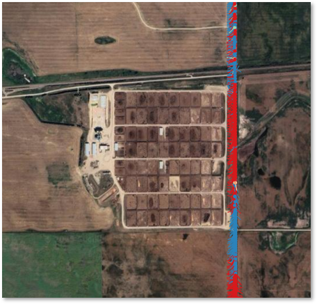
Accurate estimates of emissions rates from multi-point and heterogeneous area sources remain a persistent scientific challenge, particularly for ground-based fixed and mobile methods. A major part of our research activities is in developing, testing, and implementing new plume modeling methods for these sources. These data‑driven inversion methods combine high‑frequency mobile measurements with multi-source dispersion modeling to infer emission patterns directly from plume structure, improving our ability to recover both site‑level fluxes and fine‑scale spatial variability of fluxes under conditions where traditional point‑source models fail. This work enhances our capacity to generate robust, scalable emissions intelligence that supports climate mitigation, regulatory development, and evidence‑based environmental management. Case studies include wastewater treatment plants, biosolids lagoons, landfills, feedlots, coal mines, and large oil and gas facilities.
Year
2017 - Present
Data Analytics

Our vehicle‑based methane monitoring program—now the longest‑running, year‑round mobile emissions dataset in North America and approaching one trillion individual records—provides an independent, empirical foundation for evaluating the real‑world effectiveness of methane regulations and policy across Western Canada, as well as a host or other methane sources (small farms, feedlots, landfills, gas leaks, coal mines, wastewater treatment, industrial processes, etc.). In parallel, our work on Alberta’s alternative FEMP dataset focuses on assessing regulatory performance at scale using the province’s unprecedented, publicly released records spanning thousands of facilities, multiple detection technologies, and diverse program designs. Together, these two complementary data streams allow us to rigorously examine how regulatory frameworks translate into measurable emissions outcomes, offering transparent, evidence‑based insights that directly support policy evaluation and methane‑reduction strategies.
Year
2021 - Present
Aeolian Research
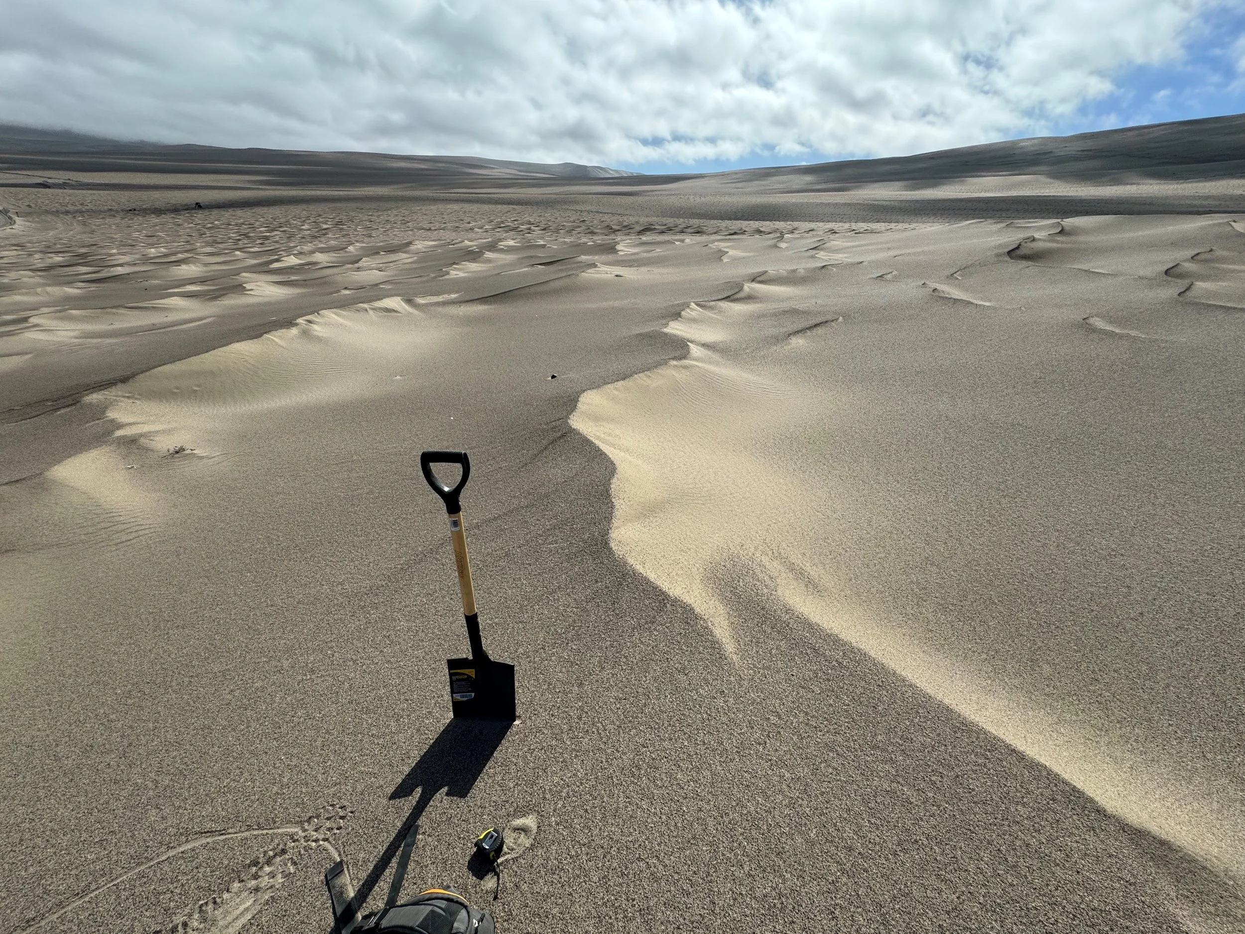
What do subaerial sand particles and airborne methane molecules have in common? The answer is that their transport rates are controlled by wind. Accordingly, we draw heavily on our experience measuring and modeling wind-driven (aeolian) particle transport on Earth and Mars to model and estimate methane emissions. We continue to work on a longstanding issue in aeolian research involving the formation and mechanics of large ripples, which are common on Mars but assumed to be rare on Earth. In 2024, team members travelled to Nazca Peru to study these features. Major findings will be shared in upcoming publications and datasets.
Years
2005 - Present